The map of Cross
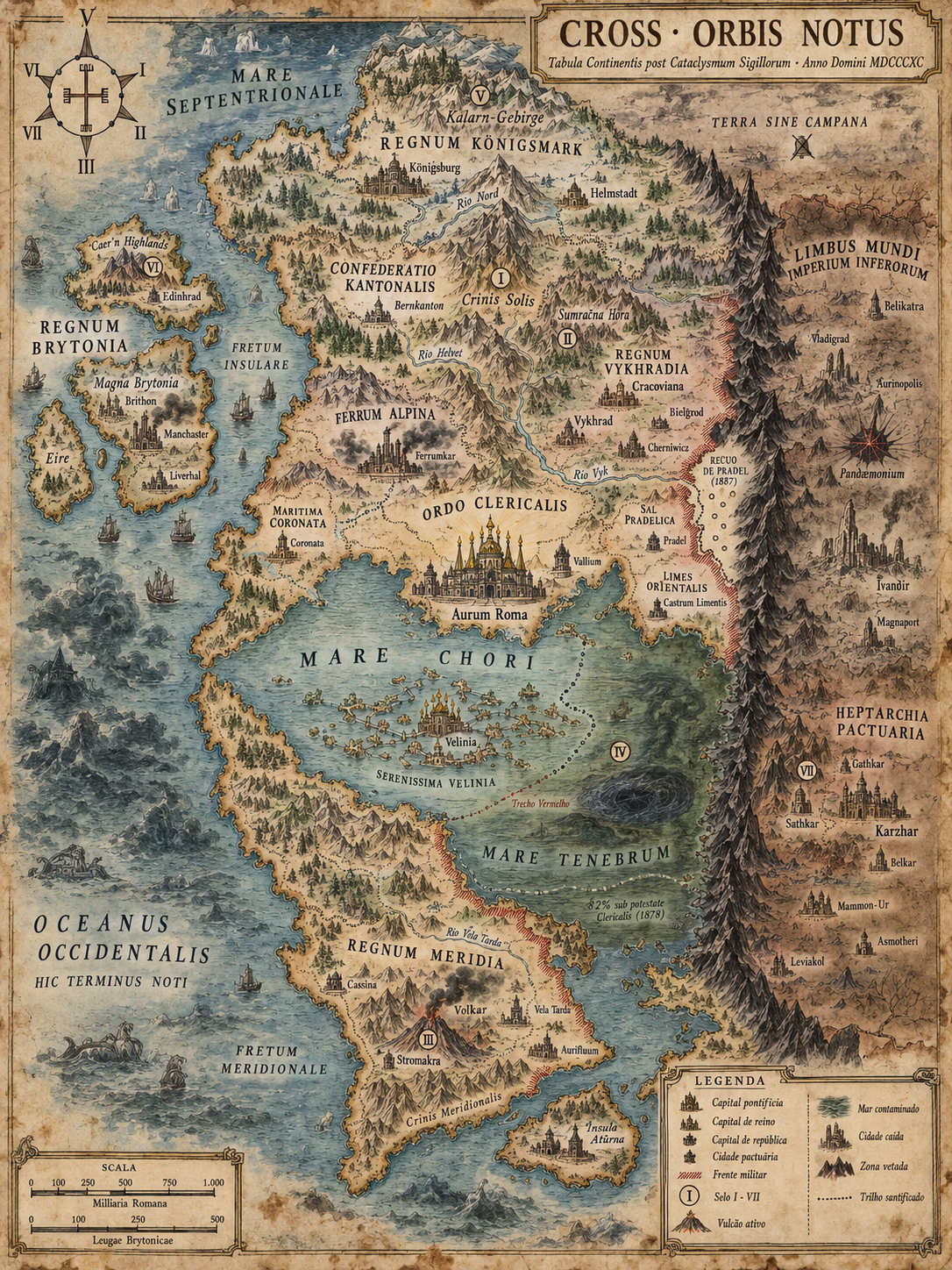
The chart of the continent in 1890. Eight powers, seven Seals, and one line that has not moved since 1859.
The illustrated chart
Cross · Orbis Notus — Tabula Continentis post Cataclysmum Sigillorum, Anno Domini MDCCCXC
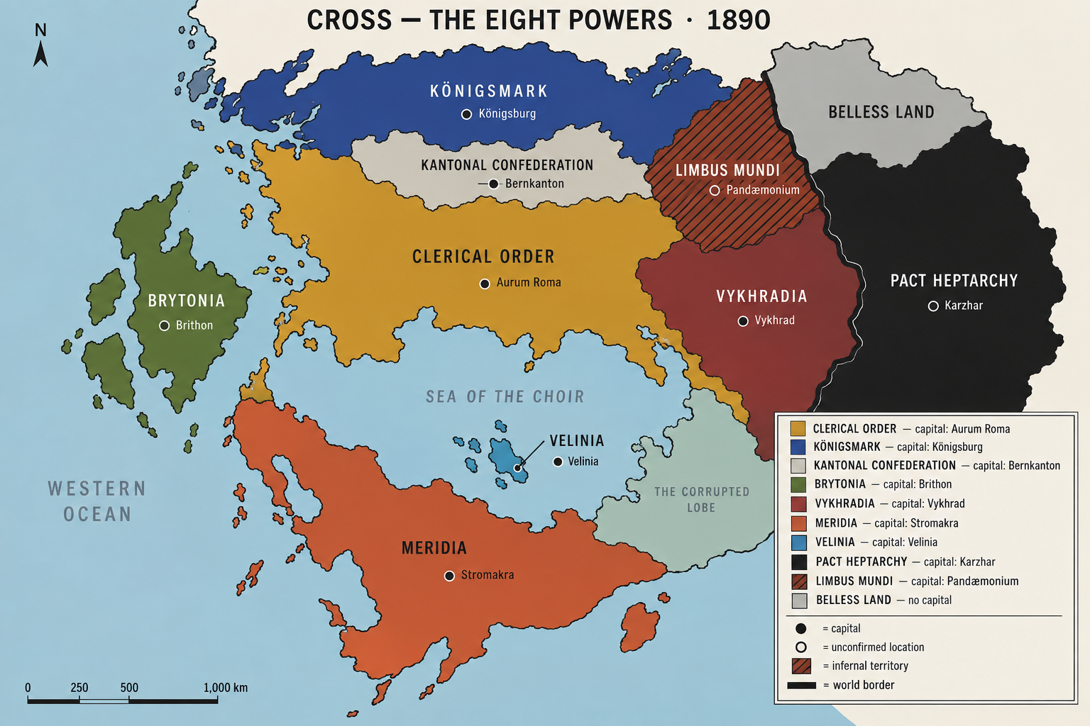
The eight powers
The same land, stripped of relief and city names: one colour per power, one dot per capital. To learn who is who before learning where is what.
How to read Cross
Three strokes organise the continent. Whoever holds them knows the whole map.
The spine
A chain of mountains runs north to south, end to end. The seven Seals are cut into it. The mountain is not scenery: it is the prison — which is why the borders of this world are geological and mining is an act of war.
The cut
The Sea of the Choir cuts the continent in half from east to west. Four hundred kilometres at its narrowest, nine hundred at its widest. It is the road of all trade — and its south-eastern lobe, the Mare Tenebrum, has been contaminated since 1780.
The line
The Limbus Mundi runs north to south along the far east, and it is not geology: it is the wake of the Archangels’ wave, frozen where it was halted in 1786. Everything west of it is the world. Everything east of it is what was not saved.
- The map of 1859 is the map of 1890. Thirty-one years without a metre of change in any direction.
- The wedge east of Cherniwicz is the only permanent territorial gain of the whole century — two hundred kilometres, taken by train in nine days.
- The notch marked Recuo de Pradel (1887) is twenty-two kilometres lost without a fight, for want of purifiers. Nine villages evacuated.
- Pandæmonium is drawn, but it has no coordinate. Three expeditions, three incompatible maps, and one Curia cartographer charged since 1857 with reconciling them.